
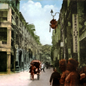
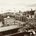
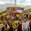
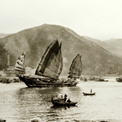
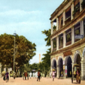
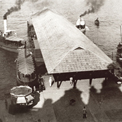
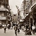
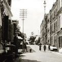
Aerial view of Shatin Pass
Po Kong (the mound in the centre, present-day location around Choi Hung Road Playground)and Kowloon City (right) in the distance from Chuk Yuen around 1910. The footpath in the picture leads all the way to Shatin, and was later expanded to become today's Shatin Pass Road.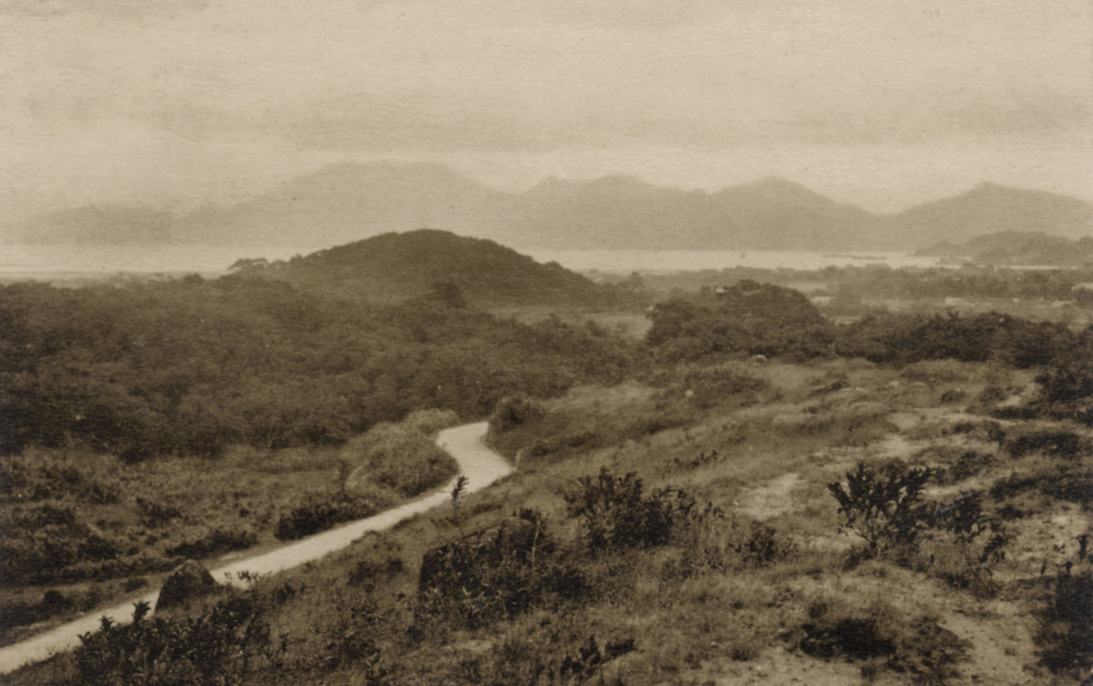
| Date | Around 1920 |
| Material Type | Image |
| Collection | Hong Kong Historical Postcards |
| Source | Courtesy of Ko Tim-keung |
| Repository | Ko Tim-keung |
| Note to Copyright | Copyright expires |
| Accession No. | 213 |
Other photos
Aerial view of Shatin Pass
Po Kong (the mound in the centre, present-day location around Choi Hung Road Playground)and Kowloon City (right) in the distance from Chuk Yuen around 1910. The footpath in the picture leads all the way to Shatin, and was later expanded to become today's Shatin Pass Road.
| Date | Around 1920 |
| Venue | Kowloon City | Po Kong | Shatin Pass Road |
| Material Type | Image |
| Collection | Hong Kong Historical Postcards |
| Source | Courtesy of Ko Tim-keung |
| Repository | Ko Tim-keung |
| Note to Copyright | Copyright expires |
| Accession No. | 213 |
Other photos
Aerial view of Shatin Pass
Po Kong (the mound in the centre, present-day location around Choi Hung Road Playground)and Kowloon City (right) in the distance from Chuk Yuen around 1910. The footpath in the picture leads all the way to Shatin, and was later expanded to become today's Shatin Pass Road.
| Date | Around 1920 |
| Material Type | Image |
| Collection | Hong Kong Historical Postcards |
| Source | Courtesy of Ko Tim-keung |
| Repository | Ko Tim-keung |
| Note to Copyright | Copyright expires |
| Accession No. | 213 |
Other photos
Aerial view of Shatin Pass
Po Kong (the mound in the centre, present-day location around Choi Hung Road Playground)and Kowloon City (right) in the distance from Chuk Yuen around 1910. The footpath in the picture leads all the way to Shatin, and was later expanded to become today's Shatin Pass Road.
| Date of Death | Around 1920 |
| Material Type | Image |
| Collection | Hong Kong Historical Postcards |
| Source | Courtesy of Ko Tim-keung |
| Repository | Ko Tim-keung |
| Note to Copyright | Copyright expires |
| Accession No. | 213 |
Other photos
Aerial view of Shatin Pass
Po Kong (the mound in the centre, present-day location around Choi Hung Road Playground)and Kowloon City (right) in the distance from Chuk Yuen around 1910. The footpath in the picture leads all the way to Shatin, and was later expanded to become today's Shatin Pass Road.
| Date | Around 1920 |
| Material Type | Image |
| Collection | Hong Kong Historical Postcards |
| Source | Courtesy of Ko Tim-keung |
| Repository | Ko Tim-keung |
| Note to Copyright | Copyright expires |
| Accession No. | 213 |
Other photos
Aerial view of Shatin Pass
Po Kong (the mound in the centre, present-day location around Choi Hung Road Playground)and Kowloon City (right) in the distance from Chuk Yuen around 1910. The footpath in the picture leads all the way to Shatin, and was later expanded to become today's Shatin Pass Road.
| Date | Around 1920 |
| Material Type | Image |
| Collection | Hong Kong Historical Postcards |
| Source | Courtesy of Ko Tim-keung |
| Repository | Ko Tim-keung |
| Note to Copyright | Copyright expires |
| Accession No. | 213 |
Other photos
Copyright © 2012 Hong Kong Memory